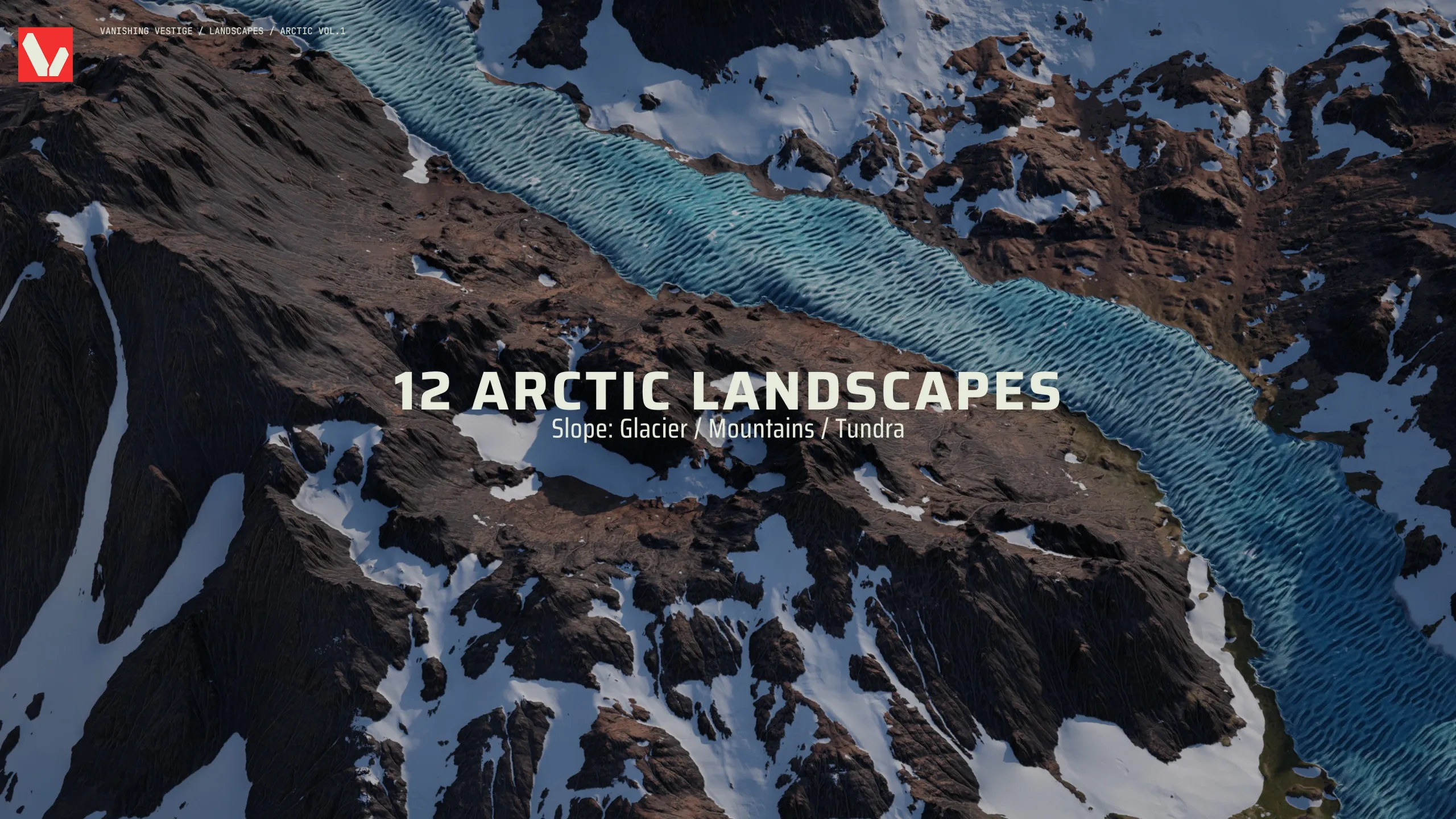
8k Landscapes - Arctic Vol.1
8k Landscapes - Arctic Vol.1
*** PLEASE READ ***
PRODUCT
8k Landscapes - Arctic Vol.1
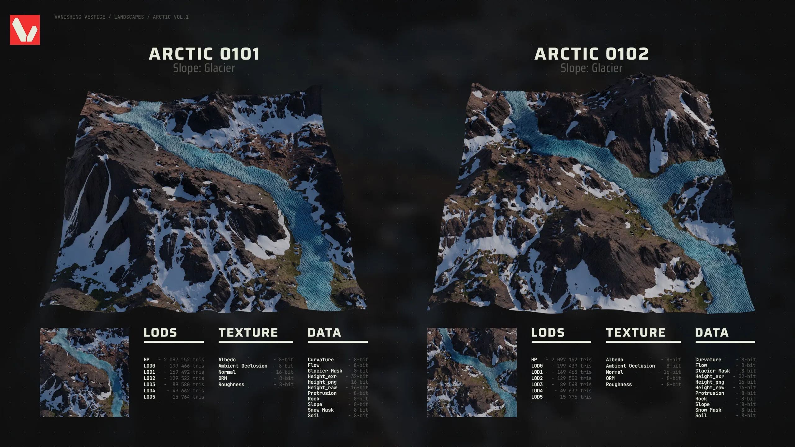
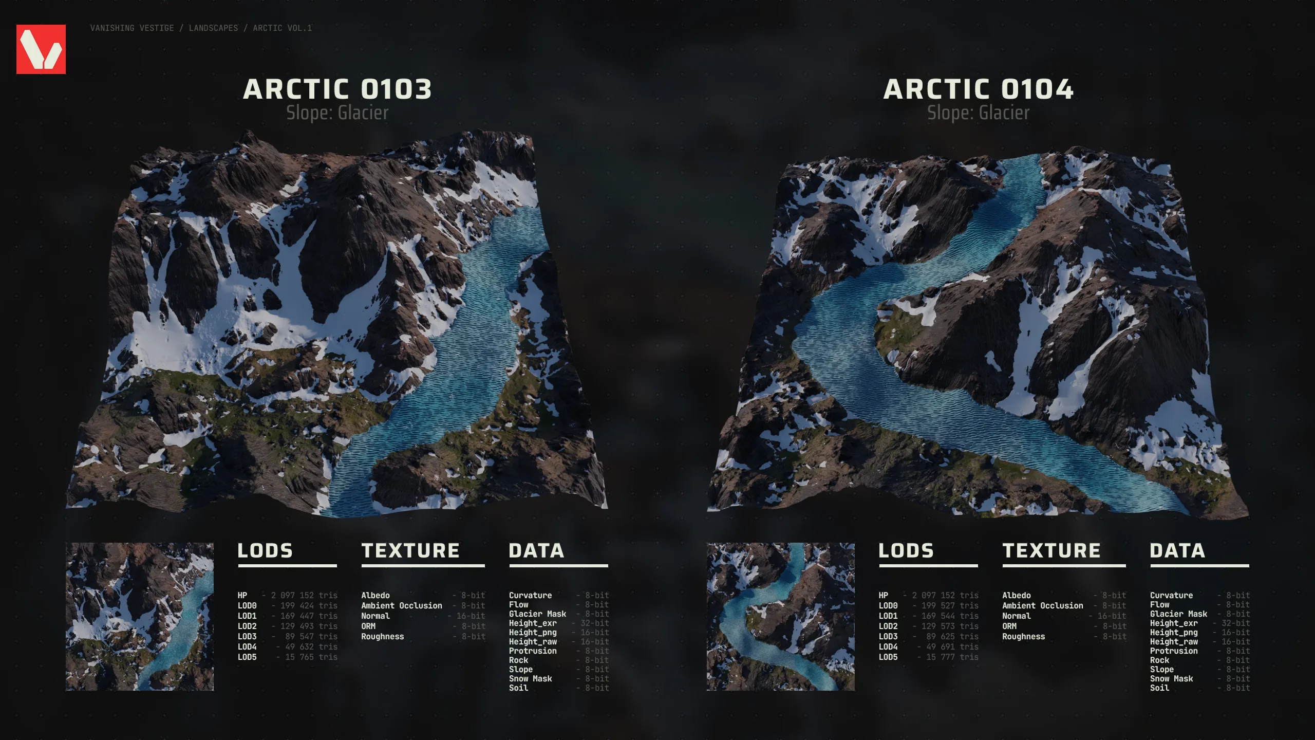
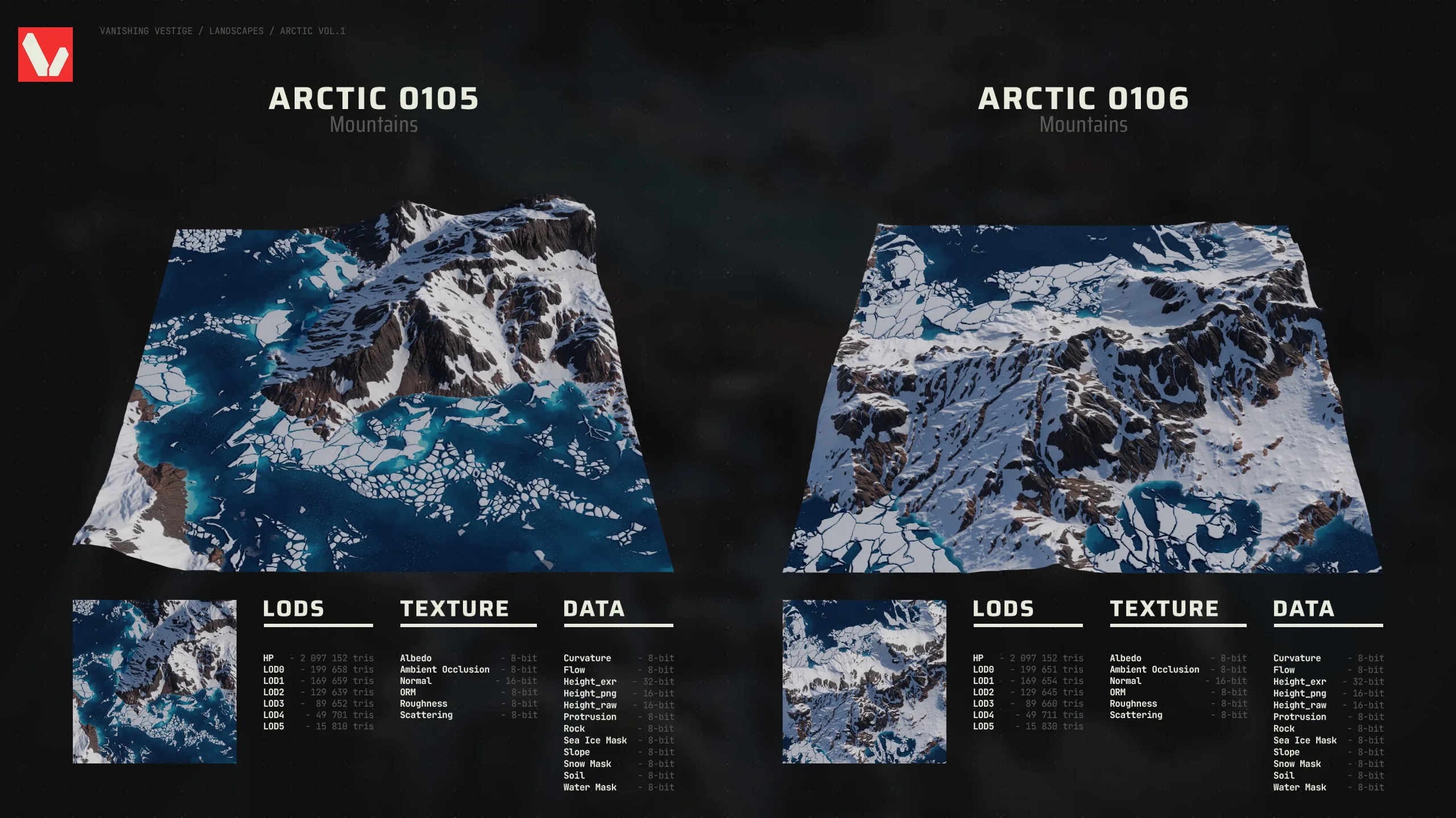
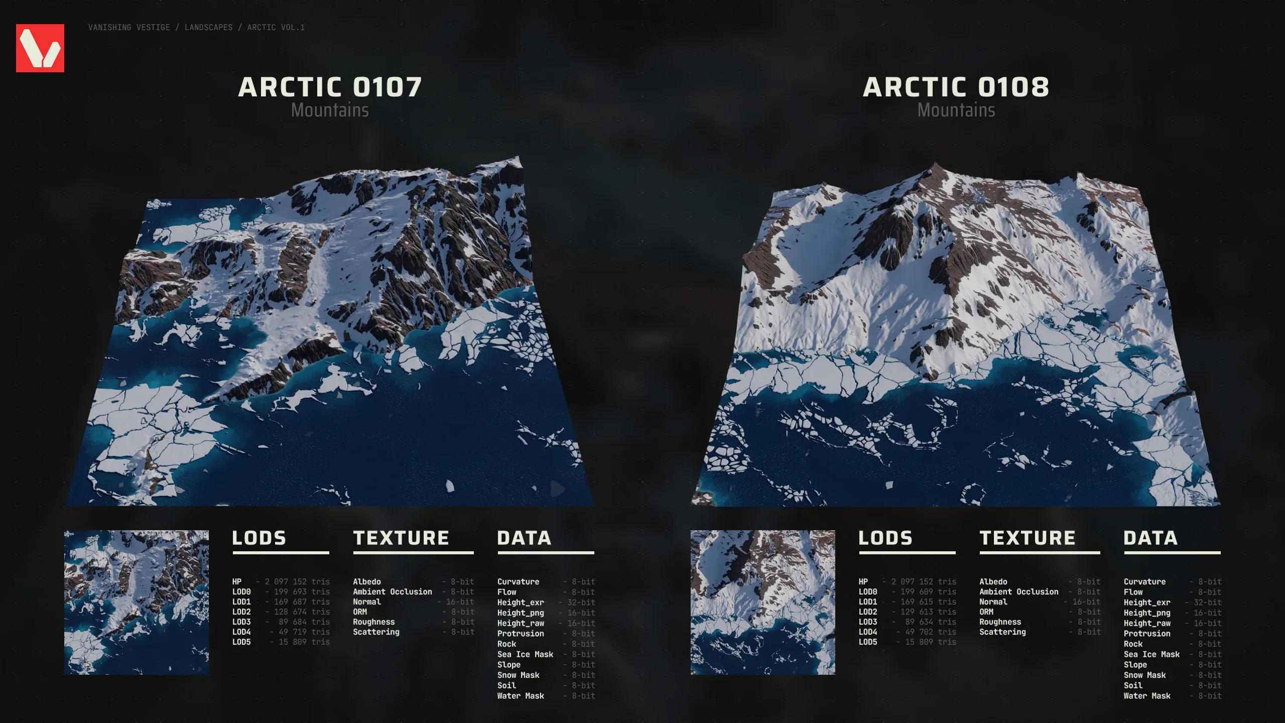
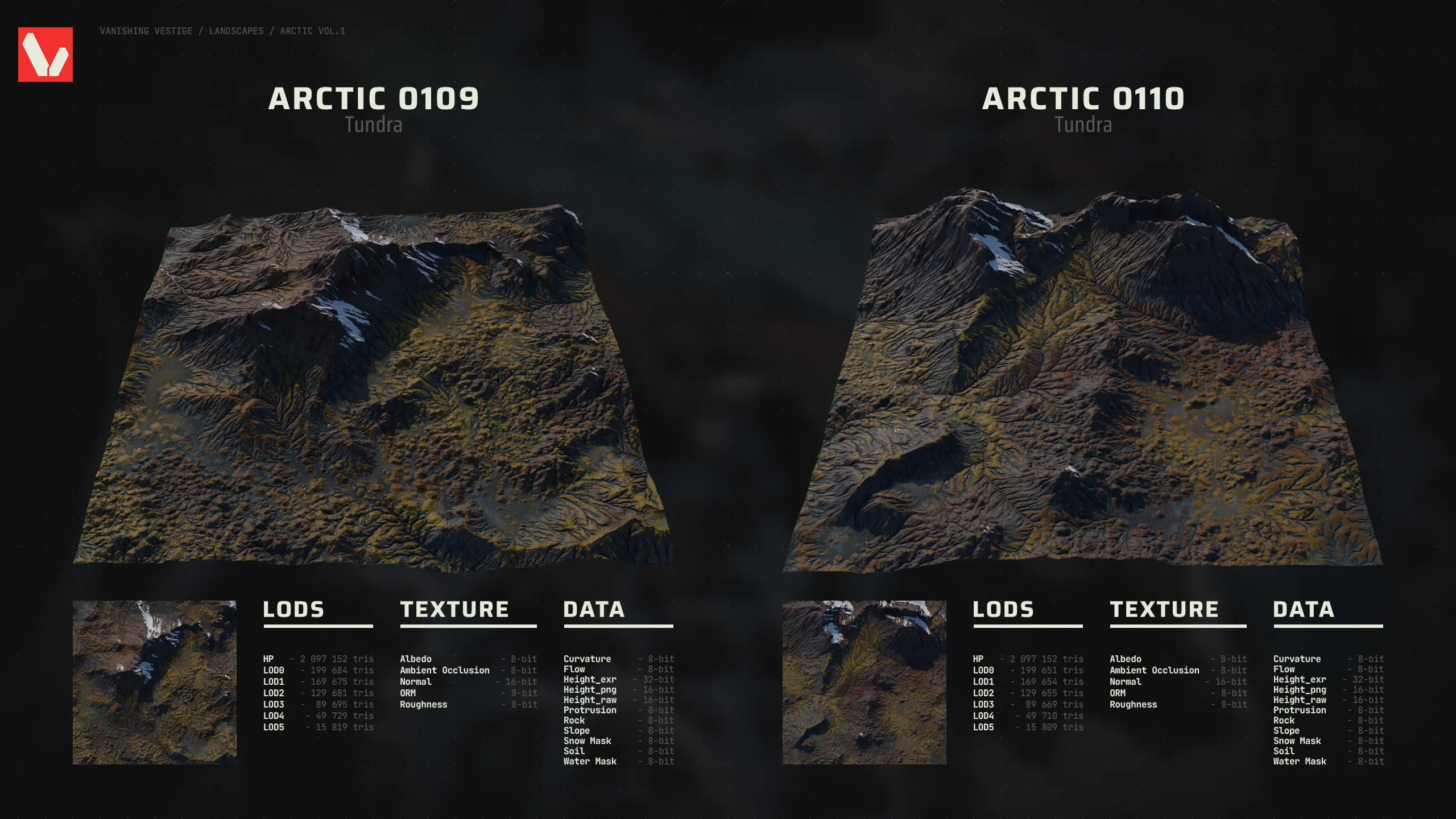
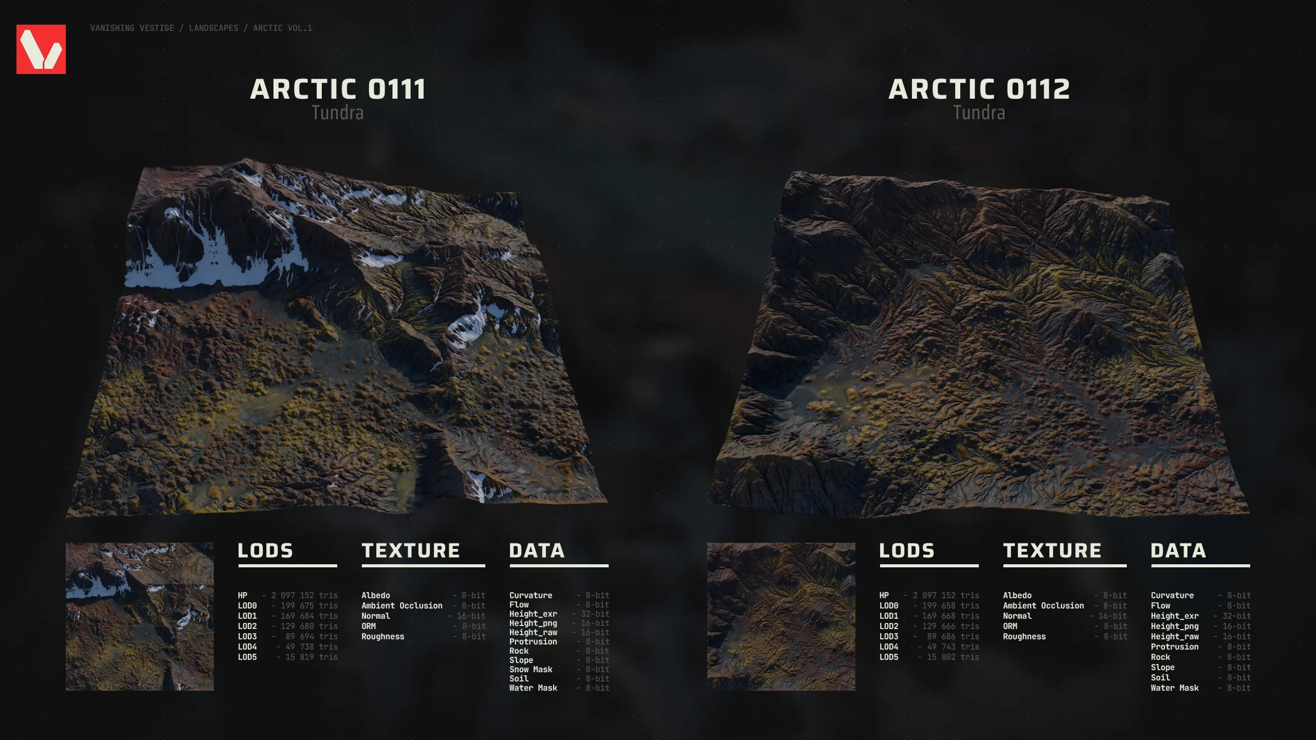
12 included - 3 Types: Slope: Glacier / Mountains / Tundra
EACH LANDSCAPE INCLUDES:
-HP, LOD0, LOD1, LOD2, LOD3, LOD4, LOD5 (FBX files)
-8k Texture maps (PNG files)
-8k Data maps (PNG files except for 2 of the 3 heightmap files, which are EXR and RAW)
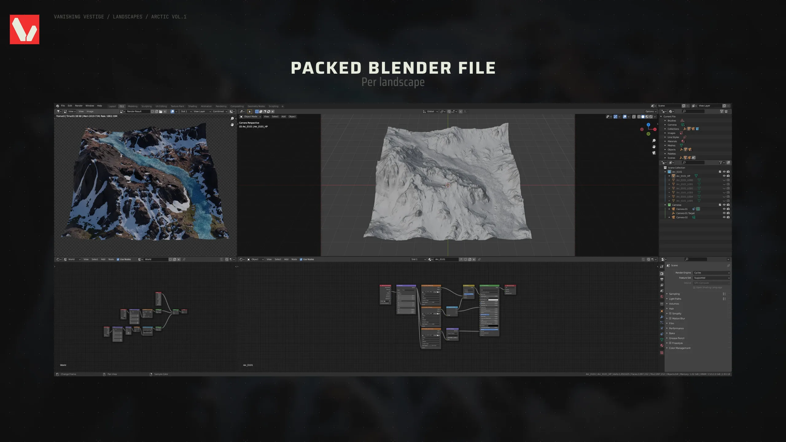
-A packed Blender file with a render setup
PLEASE CHECK THE IMAGES TO SEE THE TRI-COUNT PER LOD & INCLUDED MAPS
You can see a preview of the packed Blender file in the last picture from the image gallery. The files are also provided separately and can be used in any 3D software you want. Face maps available in the Blender file for bodies of water (except rivers) on all LODs (except HP).
These can be used as meshes, but can also be used as landscapes in Unreal Engine thanks to the data maps (You can use the PNG / RAW heightmap files for this. Depending on the size of your landscape, you will need to adjust the Z scale. 100% for 1009, 200% for 2017, 400% for 4033, etc.). A bit more info on this in the "_readme" file included.
8k Landscapes - Arctic Vol.1
*** PLEASE READ ***
PRODUCT
8k Landscapes - Arctic Vol.1
12 included - 3 Types: Slope: Glacier / Mountains / Tundra
EACH LANDSCAPE INCLUDES:
-HP, LOD0, LOD1, LOD2, LOD3, LOD4, LOD5 (FBX files)
-8k Texture maps (PNG files)
-8k Data maps (PNG files except for 2 of the 3 heightmap files, which are EXR and RAW)
-A packed Blender file with a render setup
PLEASE CHECK THE IMAGES TO SEE THE TRI-COUNT PER LOD & INCLUDED MAPS
You can see a preview of the packed Blender file in the last picture from the image gallery. The files are also provided separately and can be used in any 3D software you want. Face maps available in the Blender file for bodies of water (except rivers) on all LODs (except HP).
These can be used as meshes, but can also be used as landscapes in Unreal Engine thanks to the data maps (You can use the PNG / RAW heightmap files for this. Depending on the size of your landscape, you will need to adjust the Z scale. 100% for 1009, 200% for 2017, 400% for 4033, etc.). A bit more info on this in the "_readme" file included.